
What Bryce is and why it is different from every other park near Las Vegas
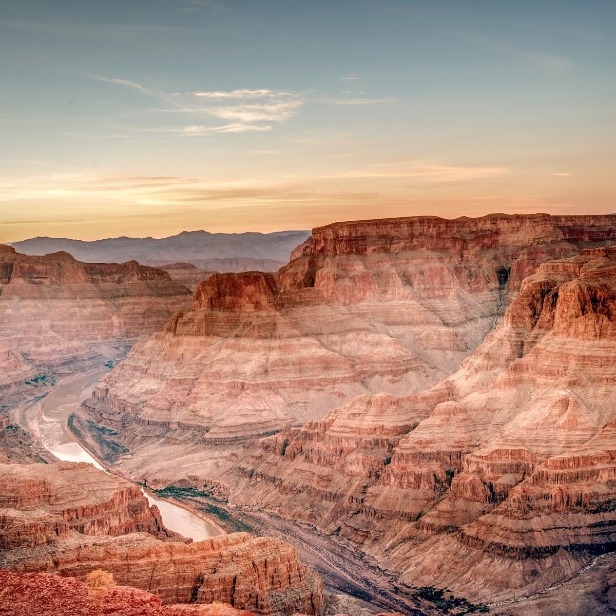
Bryce Canyon National Park is a 20-mile rim of pink and orange limestone amphitheaters carved into the edge of the Paunsaugunt Plateau in southern Utah, filled with the largest collection of hoodoos — freestanding rock spires — on earth. It is not a canyon at all; there is no river, and nothing flows through it. Frost and rain do the sculpting, freezing in the cracks 200 nights a year and prising the rock apart. The result looks like nothing else in the Southwest: a forest of stone towers glowing in the morning light, seen from viewpoints strung along a rim that sits at 8,000 to 9,100 feet.
That altitude is the point and the catch. Bryce is cool in summer, snow-covered for much of the winter and thin-aired all year; visitors from sea level notice the stairs. It is also 260 miles from the Strip, four hours minimum, which is why it is the one park in this hub where an overnight is not a luxury but the sensible plan. Combined with Zion, which sits on the way, it makes the best two-day trip out of Las Vegas.
The drive: four hours through Zion country
From the Strip, I-15 north for about 125 miles to Utah, then either UT-9 east through Springdale and Zion (the Mount Carmel Highway with its tunnel, then US-89 north and UT-12 east) or the faster, plainer route continuing on I-15 to Cedar City and UT-14 or UT-20 across to US-89. The Zion route is about 260 miles and four and a half hours with no stops and is one of the most beautiful roads in America; the Cedar City route is about 270 miles and four hours and avoids the park-entrance fee and the tunnel's size restrictions on large vehicles. Utah is an hour ahead of Las Vegas.
Either way, the last stretch on UT-12 through Red Canyon — a mini-Bryce with two rock tunnels cut through the highway — announces what is coming. Fuel is available in Hurricane, Cedar City, Panguitch and Bryce Canyon City at the park gate. In winter, both routes climb to 8,000 feet or higher and can be snowy and icy; check UDOT conditions and carry chains or drive a vehicle with all-wheel drive and proper tyres. The park itself keeps the main road ploughed to the amphitheater viewpoints.
What to see: the amphitheater viewpoints and the rim
Almost all the famous views are in the first three miles of the park, around Bryce Amphitheater. Four viewpoints — Sunrise Point, Sunset Point, Inspiration Point and Bryce Point — are linked by the paved Rim Trail and by the free park shuttle, which runs from roughly April to October. Do them all; each gives a different angle on the same bowl of hoodoos, with Bryce Point the widest and Inspiration Point's upper level the most vertiginous. Despite the names, both Sunrise and Sunset Points are best at sunrise, when the low sun lights the amphitheater from the east and the rock turns from pink to flaming orange.
With more time, drive the 18-mile main road south to Rainbow Point at 9,100 feet, stopping at Natural Bridge (an arch, not a bridge), Agua Canyon and Farview Point; the round trip is about 90 minutes with stops. The visitor centre by the entrance has the map, the geology and the night-sky programme — Bryce is an International Dark Sky Park and the ranger-led astronomy nights are excellent. Mossy Cave, a short trail off UT-12 outside the main entrance, has a small waterfall and hoodoos at valley level without the altitude.
The hikes: Navajo Loop, Queens Garden and going down among the hoodoos
The rim is spectacular; the trails below it are why people come back. The classic is the Navajo Loop and Queens Garden combination, about 3 miles from Sunset Point down through the Wall Street slot (closed in winter for rockfall risk), past Thor's Hammer and up through Queens Garden to Sunrise Point, with about 600 feet of climb back out at altitude. Allow two to three hours and start early; it is busy by mid-morning. The Peekaboo Loop (5.5 miles) adds the best hoodoo views in the park and is quieter. The Rim Trail between the four main viewpoints is 1 to 5 miles, mostly flat and paved in sections.
In winter, Queens Garden and the Navajo Loop's Two Bridges side are usually open and packed down; traction spikes, sold at the park gate, are close to essential. Snowshoes and cross-country skis can be rented in Bryce Canyon City for the rim and the Fairyland loop road. Whatever the season, remember that every trail descends first and climbs last, at 8,000 feet; take it slowly and carry water. Horseback and mule rides into the amphitheater run from spring to autumn from the lodge, roughly $75–$150 as of 2026; check the concessionaire for current prices.
Tour versus self-drive
Coach tours from the Strip that reach Bryce almost always combine it with Zion in a single 14- to 16-hour day, giving roughly two hours at each park — a drive-by of the rim viewpoints with no time to descend. As of 2026 they run roughly $200–$350 per person; check operators for current rates. Multi-day small-group tours (two to four days, taking in Zion, Bryce, sometimes Antelope Canyon and the Grand Canyon) are the better guided option, typically $500–$1,200 per person with lodging. Small-plane sightseeing flights over Bryce from Las Vegas are occasionally offered; see the scenic flights page.
Self-driving is the way to do Bryce properly. A rental car and one hotel night give you sunrise at the rim, the Navajo Loop before the crowds and a leisurely drive home through Zion or Red Canyon. For a single very long day it is technically possible — leave at 4 a.m., arrive 9 a.m. Mountain Time, three hours in the park, home by 8 p.m. — but you will see the park at its flattest midday light and spend nine hours driving for three hours there. If a single day is all you have, spend it at Zion instead. Our car rental guide covers the practicalities.
Best season, snow and altitude
Bryce has two great seasons and two good ones. Late May to September is prime: warm days in the 70s, cold nights, all trails open, afternoon thunderstorms in July and August that clear by evening. October is superb — golden aspens on the plateau, the first light snow dusting the hoodoos, thin crowds. Winter (November to March) is the photographers' season: deep snow on the rim, orange rock against white, temperatures well below freezing at dawn and the park almost empty; the main road is kept open but some viewpoints and trails close, and the shuttle does not run. April and May can be muddy and unpredictable, with late storms.
The altitude deserves respect. At 8,000 to 9,000 feet, visitors from sea level may feel headaches, shortness of breath and fatigue on the climb out of the amphitheater, and sunburn arrives fast. Drink more water than usual, go easy on alcohol the night before and give the first hour to the rim before descending. Our best time to visit guide covers the months from the Las Vegas end.
Costs, time needed and what to pack
Park entry is roughly $35 per vehicle for seven days as of 2026, covered by the $80 America the Beautiful pass, which also covers Zion on the way — the pass pays for itself on this trip alone; check the National Park Service site for current fees. Lodging: Bryce Canyon Lodge inside the park (historic, books out months ahead, roughly $200–$350 in season), Bryce Canyon City hotels at the gate (roughly $120–$300), and cheaper motels in Panguitch and Tropic, 15 to 25 minutes away. Food in and around the park is limited and pricey; a cooler helps. Fuel for the roughly 550-mile round trip is the other main cost.
Time needed: one night is the minimum for a satisfying visit — arrive by afternoon, sunset on the rim, sunrise and a hike the next morning, home by evening. Two nights with Zion is ideal. Pack for cold in every season: a warm jacket, hat and gloves for dawn even in July, sun protection for the thin air, sturdy shoes with grip (and spikes in winter), two litres of water per person, snacks, a headlamp for the astronomy nights and downloaded maps, since coverage is patchy on the plateau. See the packing list for the full kit.
Combining Bryce with Zion, Kodachrome and the Grand Staircase
The standard pairing is Zion on the way up and Bryce for the night, and it works in either direction: Zion first gets you the shuttle on a weekday morning and Bryce at sunset; Bryce first gets you the sunrise hoodoos and Zion in the afternoon shade. From Bryce, Kodachrome Basin State Park (25 minutes) is a quiet, colourful hour, and UT-12 east through the Grand Staircase–Escalante National Monument to Escalante and Boulder is one of the country's designated scenic byways — a full day on its own, and the road to Capitol Reef for anyone extending the trip.
Southeast, US-89 leads to Kanab and on to Page for Antelope Canyon and Horseshoe Bend (about three hours), and from there to the Grand Canyon South Rim, closing the grand loop back to Las Vegas that our Las Vegas and Grand Canyon itinerary describes. If your trip is short and Bryce is the dream, give it the two days it deserves and take the shorter trips — Hoover Dam, Red Rock — on the other days.


